Free Access
Figure 1
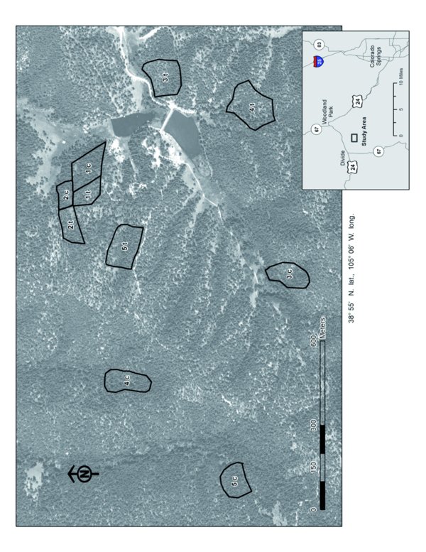
Location of experimental plots at the Catamount Center for Geography of the Southern Rockies (CCGSR) in southern Colorado, USA. Paired experimental plots are labeled 1–5, c (control; reference plot) and t (thinned; low-density plot). Pairs were chosen to be similar with respect slope, aspect, elevation, stand density, and species composition (similar representation of dominant tree species in the overstory).