Free Access
Figure 1
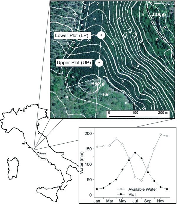
The geographic location of Monte Piantangeli with the position of the 2 study plots. Lower right box: the study site water balance (period: 1974–2006), represented by monthly potential evapotranspiration (PET) and available water (current month precipitation + previous month soil storage).